
Services
Can My Land Be Developed?
If you own the land, or you are close to buying it, we can help you see whether homes can go there.
What Brian needs to start a review
Land Development Specialists LLC helps landowners in the Inland Empire, mainly Riverside County and southern San Bernardino County, decide whether a property can be developed. Brian Woods, Principal, starts with land you already own or a parcel you are considering. Owners ask when they want to develop their land into a housing community, and when they need to know if the property is buildable. Call (760) 271-1081.
Send the address, parcel number, and acreage, whether you own it or are buying it, the use you have in mind, the schedule you want, and the budget you have. Surveys, title documents, plans, utility information, agency correspondence, and earlier studies help when you have them. Sellers sometimes hold useful information. You need to ask for it.
If a tentative map has been prepared, there may already be soils reports, drainage studies, and sewer and water studies. Raw land may have much less. Looking at what already exists shows the gaps and keeps the same work from being done twice.
Before a purchase, the review also looks at permitted use, legal access, title restrictions, boundaries, utilities, drainage, soils, environmental concerns, expected approvals, and total development costs. The proposed product needs to fit the local market. For apartments, that means achievable rents and the level of finish renters expect. For homes, it means likely selling prices and the quality buyers expect at those prices. Those factors help determine whether the development costs and potential income support the purchase.
Cheap land that's costly to develop
A low price can still mean a long utility extension, major earthwork, retaining walls, an access agreement, drainage work, or environmental cleanup. In some cases the cost of preparing the land is too high to support a practical purchase price.
Brian evaluates the land through residual value. He starts with the expected value of the finished lots, then accounts for development costs, fees, financing, and the required return. That shows what the project can support paying for the land. A low asking price does not make a property a good deal if the improvements consume its development value.
An attractive site has a suitable location, practical access, available utility capacity, manageable constraints, and development costs that fit the homes. Flatter land is generally easier to develop. Greater elevation changes can require more grading and retaining walls, and they can reduce the space available for buildings. Location within a city also affects potential rents and home prices. Compare usable development potential, costs, and risks rather than looking only at acreage or purchase price. When more than one property is in play, use the same assumptions for each: purchase price, potential lot or unit count, infrastructure costs, approval risks, schedule, and unresolved questions. The lowest purchase price may not produce the best result.
No utilities, limited access, steep slopes, odd shapes
Residential zoning alone does not mean the project will work. The review asks whether the intended development fits the zoning and general plan, or whether changes would be needed. Those changes can add substantial time and uncertainty. Usable acreage, road and emergency access, utilities, drainage, and ground conditions all get a look. The design team then tests a layout and an initial cost range.
No utilities
The review names the service providers and looks at connection points, available capacity, required improvements, fees, and estimated timing. For sewer and water, an early meeting with the district can show where the facilities are and whether a line would need to be extended or increased in size. Electrical, gas, and communications get the same kind of look at routes and property rights. A nearby utility line does not mean the property can connect, or that enough capacity is available. A long off-site extension can change whether the land works.
Limited road access
Title and survey professionals establish legal access. The design team then looks at whether the route can carry construction traffic, everyday use, and emergency vehicles. An existing road may lack the rights, width, grades, or improvements the development needs. On difficult ground, the road may need cut-and-fill slopes outside the right-of-way, and those areas may need permanent grading or slope easements from neighboring owners. That adds cost and uncertainty.
Steep slopes
The review starts with topographic information and geotechnical input, then road grades, building pads, drainage, earthwork, and retaining walls. Hillside design takes specific experience: streets and lots fitted to the terrain, with grading cost kept in view. Rock, boulders, and expansive soils matter. Deep cuts through rock can be especially expensive. Comparing layouts early shows how much of the land is usable.
Odd shapes
Work starts from a measured plan of the boundaries, setbacks, easements, access, and physical constraints. Then the layout is tested for buildings, streets, utilities, and drainage. Land planning quality matters on an irregular parcel, and civil engineering should come in early so grading, drainage, and infrastructure are part of the layout from the start. A skilled land planner can use the parcel's angles and dimensions. Total acreage alone does not show how much of the property can be developed efficiently.
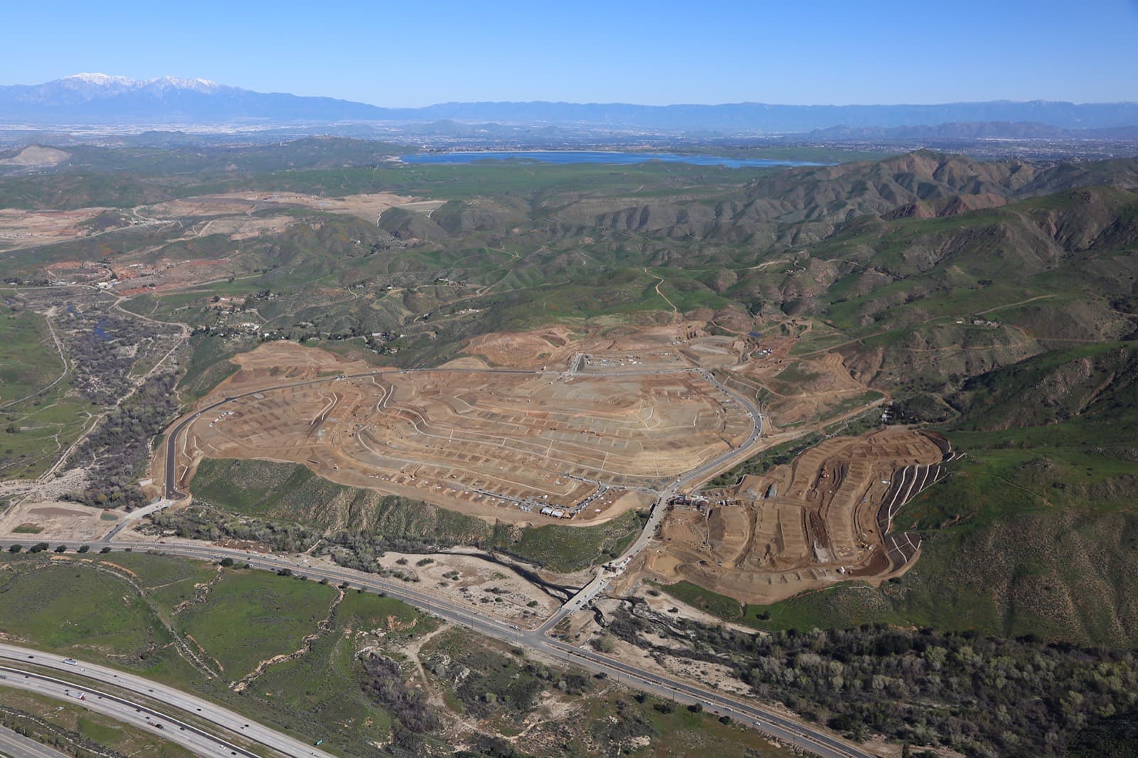
Earlier use of the land can change the answer too. Ask about industrial activity, agriculture, dumping, fuel tanks, imported fill, wells, septic systems, and demolished buildings. Historical aerial images can show former buildings or disturbed ground. Agricultural land may need a look for pesticide residues, and a former dairy may need a look at buried organic material and gas. An environmental professional determines the assessment and any further testing. Findings can affect cleanup cost, timing, and whether you proceed.
Neighbors can affect access, drainage, utility routes, noise, privacy, and where construction can stage. Some improvements depend on agreements with adjacent owners. Public hearings, neighborhood consultation, and earlier agreements can change the design and the schedule. Those questions belong in the first review, so you know which parts of the idea may move.
What a listing can't tell you
Check the listing against the records before you treat the land as buildable. Confirm whether zoning allows the advertised use, whether nearby utilities have capacity, whether access is legally adequate, and whether an advertised unit count has been approved.
The check runs through agency records, the city, the utility providers, and a site visit. A visit can show a physical constraint, or an existing utility that would have to be moved.
Dig deeper or walk away
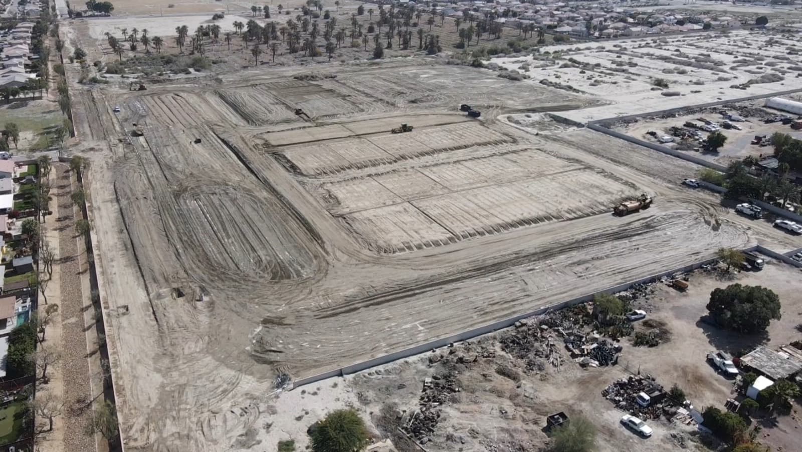
Further investigation may be needed for uncertain access, conflicting boundaries, possible contamination, undocumented fill, steep terrain, limited utility capacity, unresolved approvals, habitat impacts, or contaminated soils. Soil cleanup may require a mitigation plan, removal, and careful handling. Undocumented fill can increase grading costs. Steep terrain may require difficult road grades and substantial retaining walls. Rank each concern by how much it could change the project, and by how long a reliable answer will take.
Walking away may be appropriate when essential access cannot be secured, the intended use lacks a practical approval path, development costs exceed what the project can support, or sewer, water, or electrical service requires a major system expansion that makes the project unworkable. The recommendation comes from documented findings and realistic alternatives.
Examples that changed a purchase decision include inadequate utility capacity, unusually high connection fees, or major environmental cleanup. On some properties Brian has evaluated, sewer and water fees alone could reach about $25,000 to $30,000 per unit. That is an example from those properties, not a standard fee. Significant contamination can also change whether a buyer proceeds. Identify the cleanup scope, the cost, who is responsible, and what completion requires before anyone commits. Where it fits, the seller can finish the necessary cleanup before closing.
Next step: a feasibility study
If the first look says the land may work, the next step is a land development feasibility study. That study writes up the property records, the site, the utilities, and the cost range, so you have a clear basis to proceed, look further, reconsider the terms, or stop.
A promising opportunity has a practical approval path, workable infrastructure, realistic costs, and homes or apartments the market can support. Its major assumptions have been tested. Look carefully at any assumed increase in future sales prices. If a project depends on rising values to become profitable, that needs to be understood. Testing the project without assumed price growth shows whether it still works if the market does not improve.
When the land can support a housing community, residential subdivision development is the path for subdivisions of 50 to 200 lots. When the use needs a land use approval, that work is residential land entitlements. The full list is on the services page. To start a review, use the contact page or call (760) 271-1081.
Frequently asked questions
Is my property buildable?
The review looks at land-use rules, usable acreage, road and emergency access, utilities, drainage, and ground conditions, then tests a layout and an initial cost range. Residential zoning alone does not mean the intended development will work. It still has to fit the zoning and general plan, or the changes that would be needed have to be understood, because those changes can add substantial time and uncertainty.
What do you need to start a review of my land?
The address, parcel number, acreage, whether you own it or are buying it, the intended use, the target schedule, and the available budget. Surveys, title documents, plans, utility information, agency correspondence, and previous studies help when they exist. If a tentative map has been prepared, soils, drainage, and sewer and water studies may already be available. Raw land may have much less.
Can inexpensive land still cost too much to develop?
Yes. Low-priced land may still need long utility extensions, major earthwork, retaining walls, access agreements, drainage improvements, or environmental cleanup. Brian starts with the expected value of the finished lots, then accounts for development costs, fees, financing, and the required return, to see what the project can support paying for the land.
What if the land has no utilities or a steep slope?
The review identifies the service providers and checks connection points, capacity, required improvements, fees, and timing. A nearby utility line does not confirm a connection or enough capacity. On a steep site, the review starts with topography and geotechnical input, then road grades, pads, drainage, earthwork, and retaining walls. Deep cuts through rock can be especially expensive.
What should I check beyond a real estate listing?
Whether zoning allows the advertised use, whether nearby utilities have capacity, whether access is legally adequate, and whether an advertised unit count has been approved. The check uses agency records, the city, the utility providers, and a site visit.
When should I walk away from a property?
Walking away may be appropriate when essential access cannot be secured, the intended use lacks a practical approval path, development costs exceed what the project can support, or sewer, water, or electrical service requires a major system expansion that makes the project unworkable. The recommendation comes from documented findings.
Related pages
- Land Development Feasibility Study
Screen a site before purchase: permitted use, access, utilities, drainage, soils, environmental concerns, expected approvals, and total development costs.
- Residential Subdivision Development
Plan, entitle, and deliver residential subdivisions of 50 to 200 lots, including finished lots sequenced for home construction.
- Residential Land Entitlements
Coordinate the land use approvals for a subdivision or apartment site, including applications, agency comments, and conditions of approval.
Wondering if your land can be developed?
Send the address or parcel number, whether you own it or are buying it, and the homes you have in mind. We can tell you what a first review needs.